
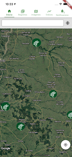
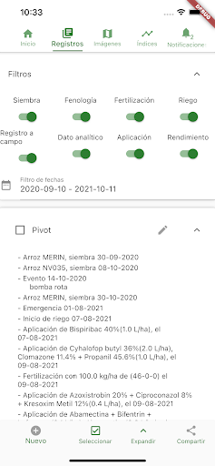
Features Oryzativa -Monitoreo Satelital
Your rice crop and those shared with you on your cell phone.The mobile application is synchronized with your account created at https://app.oryzativa.com where it loads the limit of the fields for the first time.It works offline, it is intuitive, simple and easy to use.Frequent high resolution satellite imagery in the field.Automatically generates vegetation and irrigation index maps.NDVI evolution, and daily weather in your field.Field registration of management, spraying, fertilization, sowing, phenology, irrigation, field trips with photos, yield estimation, and more.Notifications and alerts that arrive on your cell phone and can be shared with the work team (technicians, collaborators, consultants and contractors).The web or desktop version is ideal for detailed information management, viewing maps and graphics on a larger screen, measuring areas and marking field trip points that are synchronized with the mobile App on the map with GPS location.For more information write to [email protected]
Social Features
Connect and share with friends and the community.
Camera Features
Advanced camera features with editing capabilities.
Weather Features
Get accurate weather forecasts and real-time updates.
See the Oryzativa -Monitoreo Satelital in Action

Get the App Today
Available for Android 8.0 and above